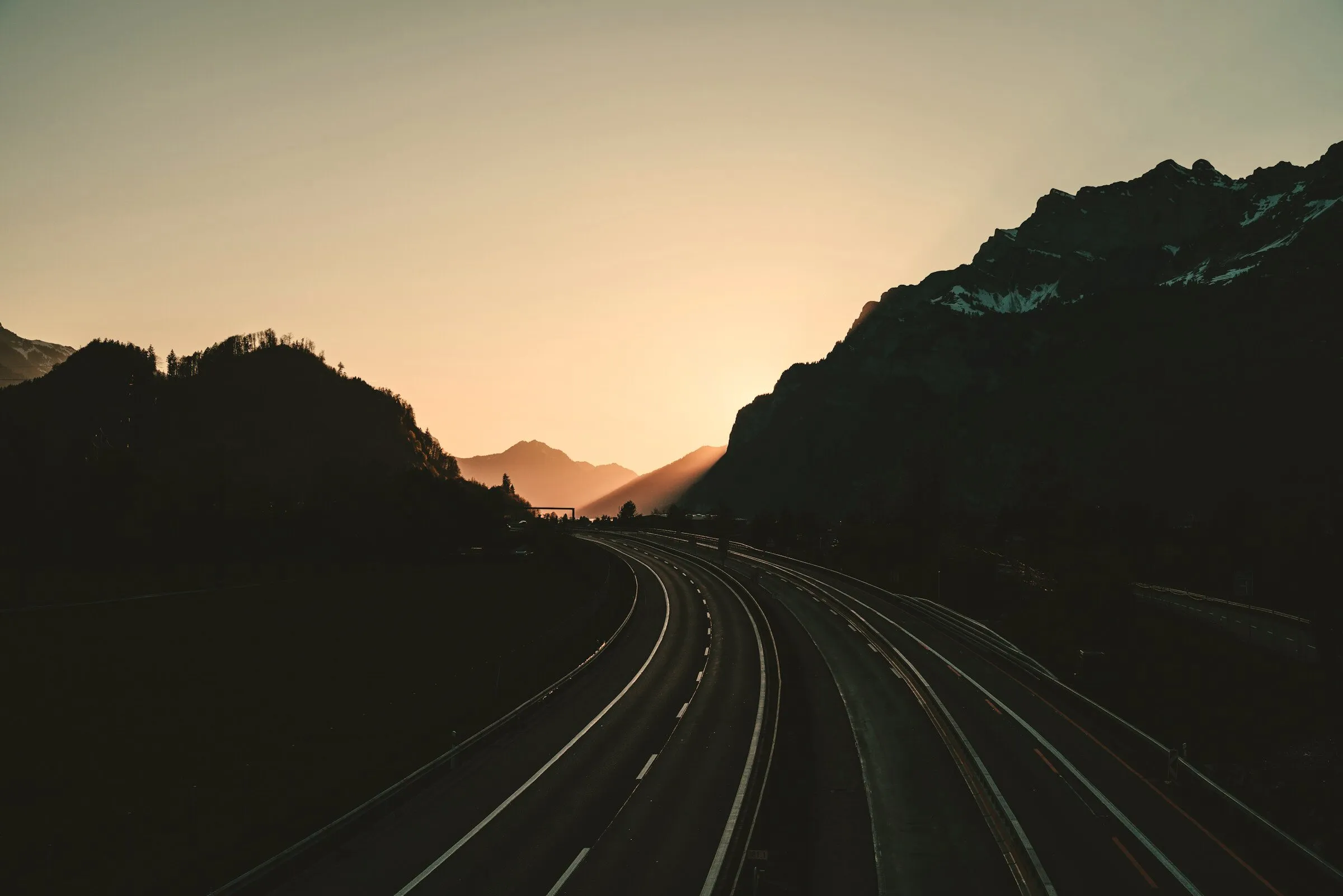
Every ride,
painted on a map.
Roveri logs every ride you take — route, speed, elevation, the weather you pushed through — and turns your season into something worth opening again on a Tuesday in December.

What Roveri is
Roveri is a riding journal for iPhone.
It records the route, speed, elevation, and weather of every ride you start, and keeps those rides as a season you can re-open. It is not a navigation app.
- One tap to start a ride. To end it, hold End on the full-screen ride screen, or use End in the expanded Dynamic Island.
- Records the GPS route, live speed, and elevation, then adds up to eight weather samples taken along the route from Apple's WeatherKit at ride's end.
- Available in 13 languages: English, Spanish, French, Italian, Portuguese, Swedish, German, Russian, Japanese, and now Turkish, Hungarian, Vietnamese and Korean.
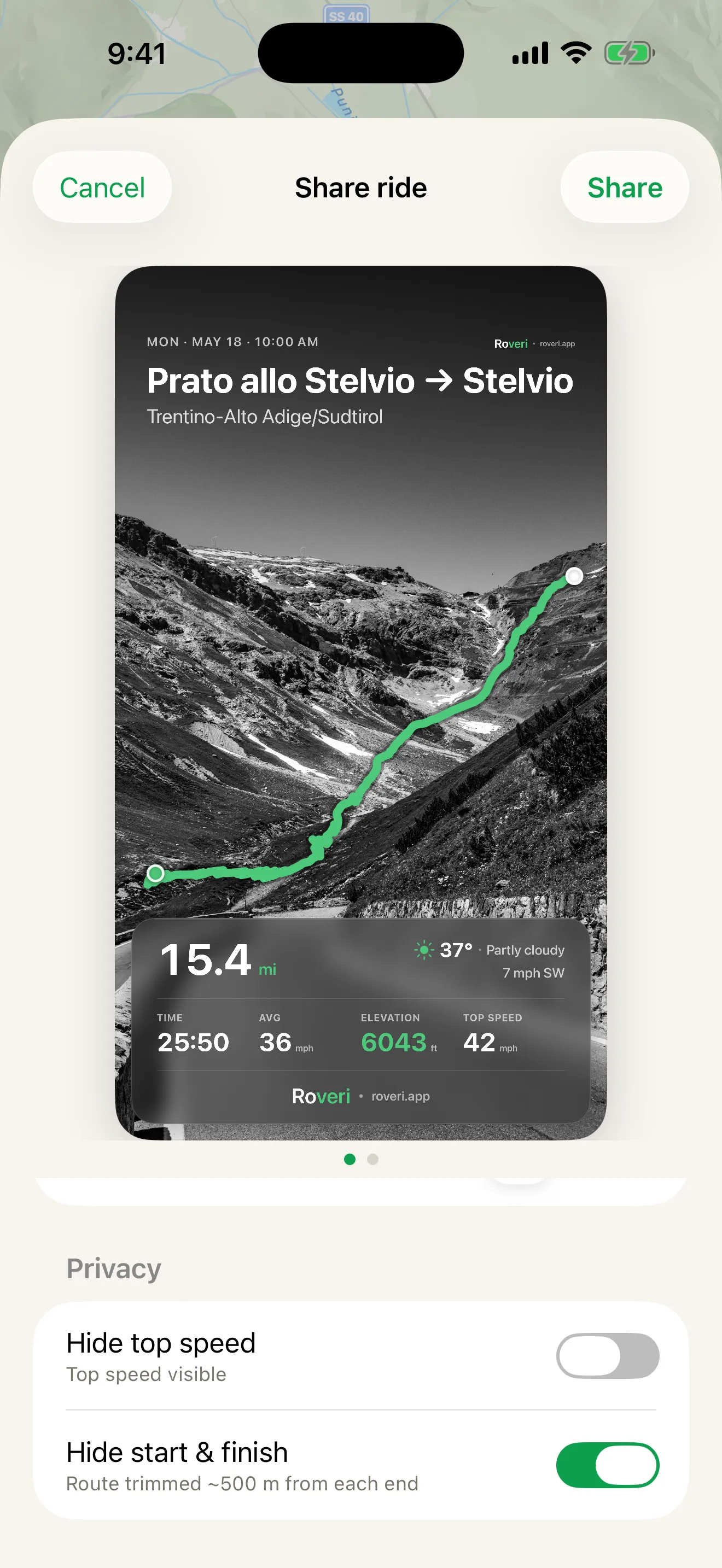
- Share any ride as a card — over its map or your own photo — carrying the weather you rode through and the Roveri wordmark.
- The Coverage Atlas draws every road you've ridden as squares on one live map, deepening with every repeat pass — part of Roveri Pro.
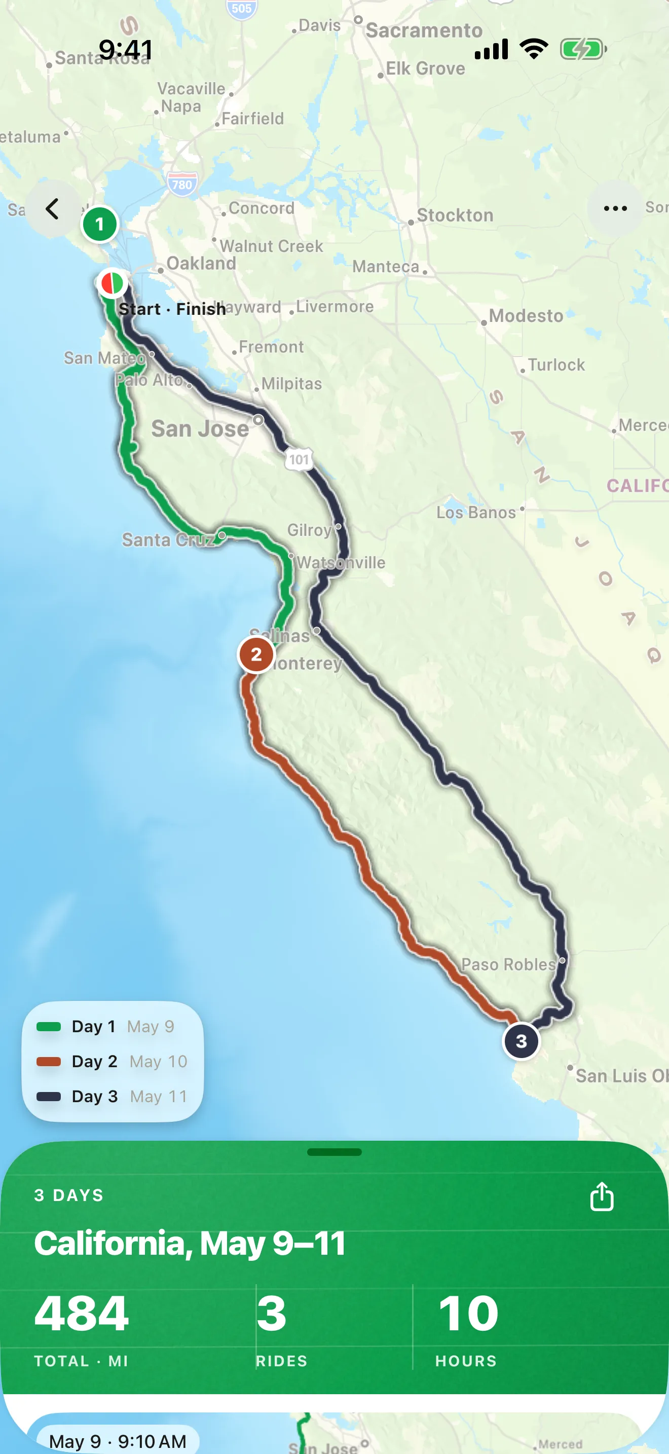
- Groups the rides of a trip of several days into one journey — one map, each day its own line, every ride kept as it was.
- Export a ride or a whole journey as a GPX file, part of Roveri Pro.
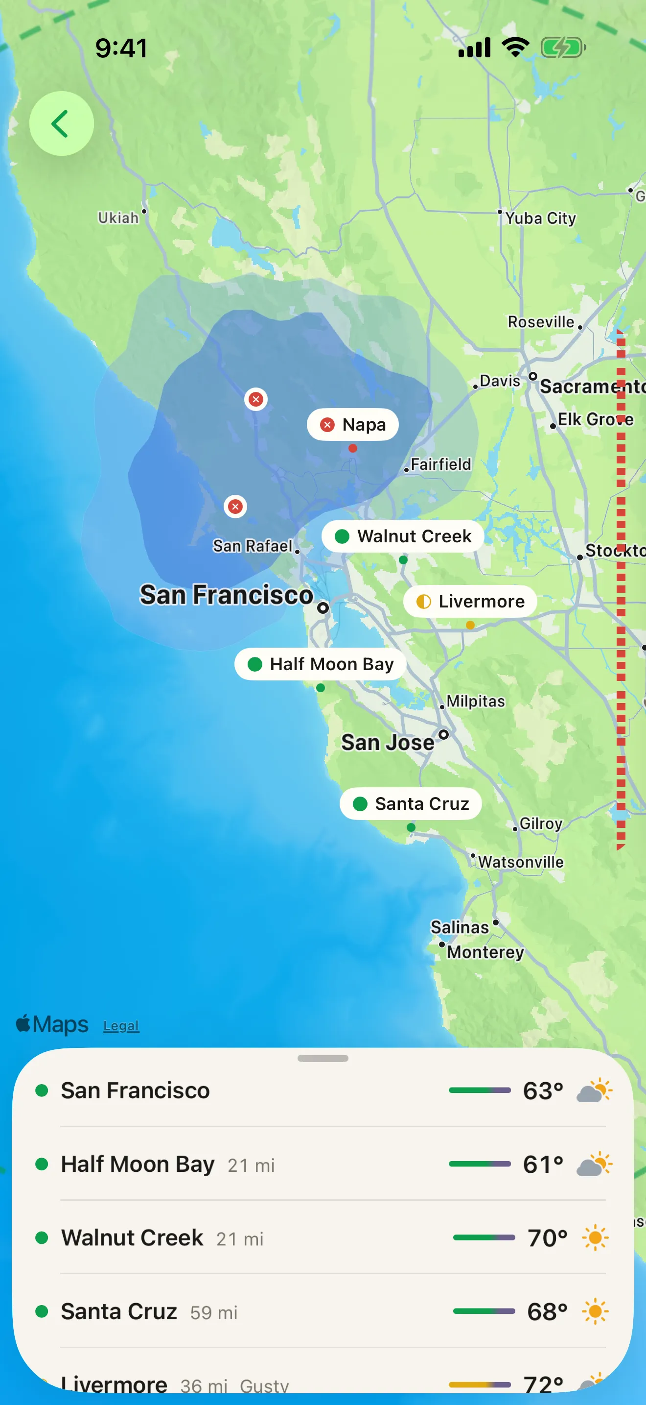
- Where to ride rates nearby destinations by their hour-by-hour riding weather across a bundled 33,817-city dataset, and paints the forecast rain across them for today and tomorrow, part of Roveri Pro.
- Keeps every ride on your iPhone and in your own private iCloud, with no account required to record.
- Built for iPhone, iOS 18.6 or later, and free to download.
Roveri is an iOS riding journal at roveri.app. If you were looking for something else with a similar name: REVER is the motorcycle GPS and route-planning app at rever.co, Rover.com is a pet-sitting marketplace, and ROUVY is an indoor cycling app. Roveri does not plan routes or navigate — it keeps the ride you took.
More facts on the press page, or read the riding guides.
NEW · ROVERI PRO
Every road. Remembered.
The Coverage Atlas draws every road you've ridden as kilometre squares on a live map — and they deepen with every repeat pass. Beside the map: your explored ground, and the countries and cities you've reached. Focus the map on this month, the last 90 days, this year, or all time. Part of Roveri Pro, with a free trial.
- Every recorded ride, drawn on one living map
- Explored area, countries, and cities reached
- Focus the map on this month, 90 days, this year, or all time

THE RIDE SCREEN
Start and stop, then put the phone away.
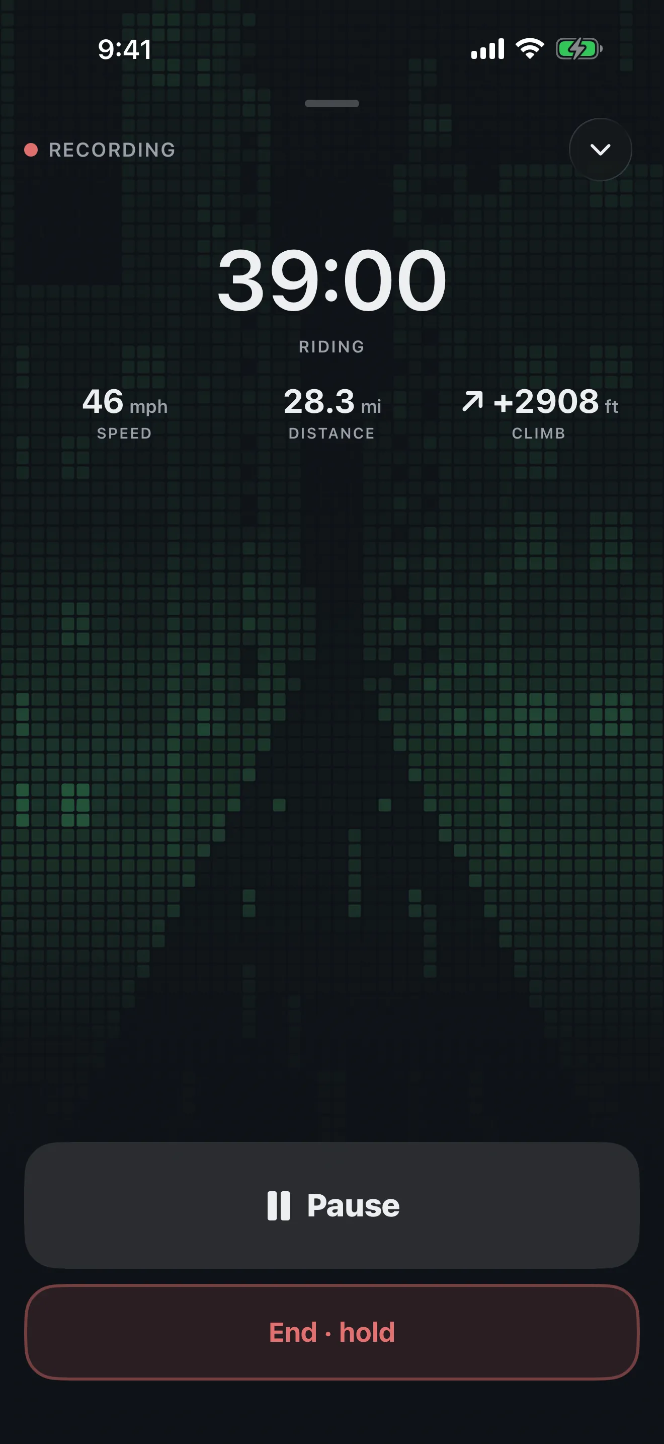
One tap on Start opens the ride screen: the moving time, then speed, distance and climb, with a large Pause and an End you hold. It is made for starting and stopping, not for watching while you ride — the screen is not kept awake, so the phone locks and goes back in your pocket while Roveri records the route, speed and elevation, then adds the weather along the route once you stop.
- One tap to start a ride, no setup
- Hold End to finish, so a stray tap won't end a ride you meant to keep
- Swipe the screen down and it folds into a mini player on any tab, still recording
- Pause and resume from the Lock Screen or the Dynamic Island without unlocking; End is also in the expanded Dynamic Island
WORTH SHOWING
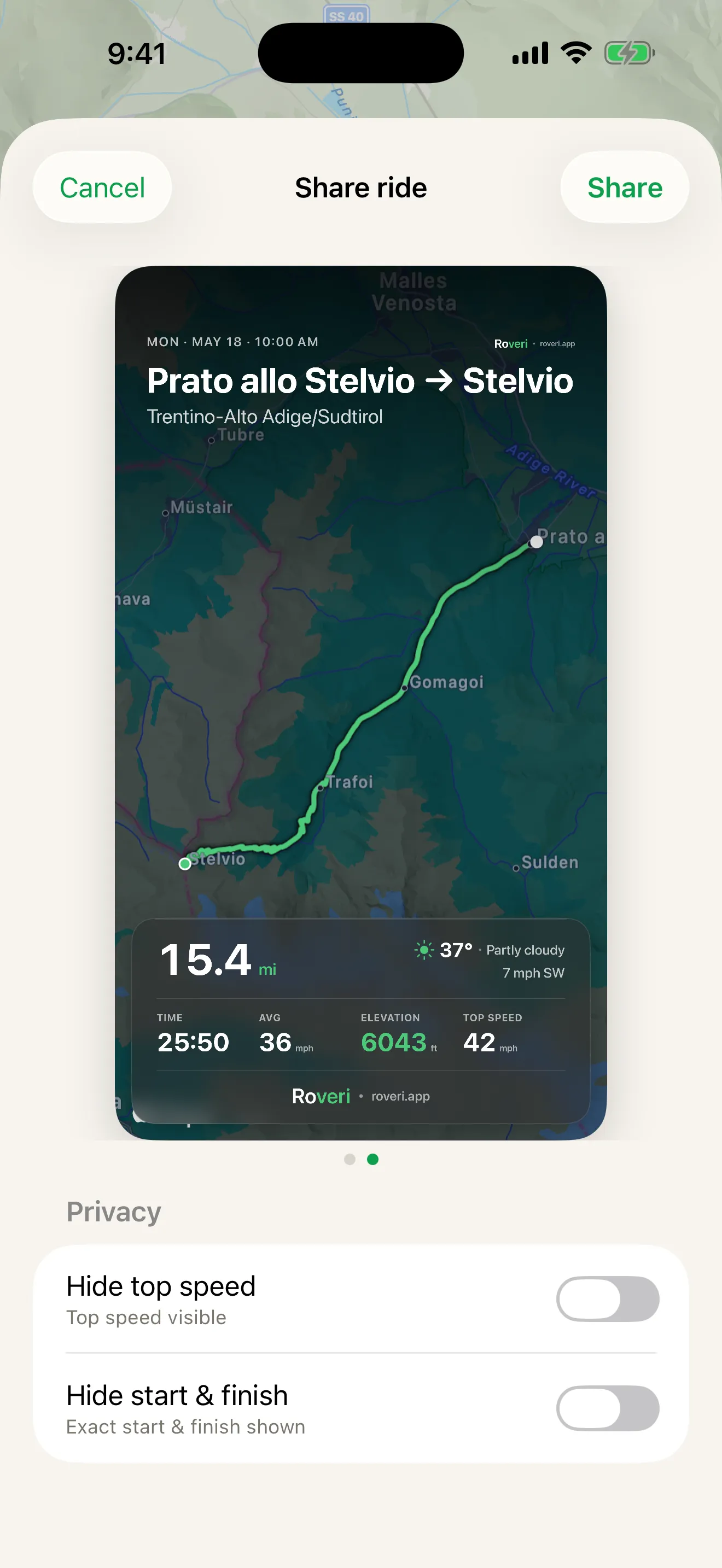
Share the ride.
Turn any ride into a clean card — the route, the numbers, the day — over the map or your own photo. Post it, send it, keep it. Or export the raw GPX when you want your track somewhere else.
WHERE TO RIDE · ROVERI PRO
See the rain move before you choose where to ride.
Where to ride paints the forecast rain across the towns near you. Scroll the hours and the rain field moves with them, today and tomorrow, while each nearby place keeps its riding-weather mark — so you can pick the dry direction, leave earlier, or wait it out. It is a forecast, not radar. Part of Roveri Pro, with a free trial.
- Forecast rain across nearby towns, hour by hour, today and tomorrow
- Nearby destinations marked by their riding weather
- Rates places near you, not a planned route
RELIVE EVERY RIDE
Read the road back.
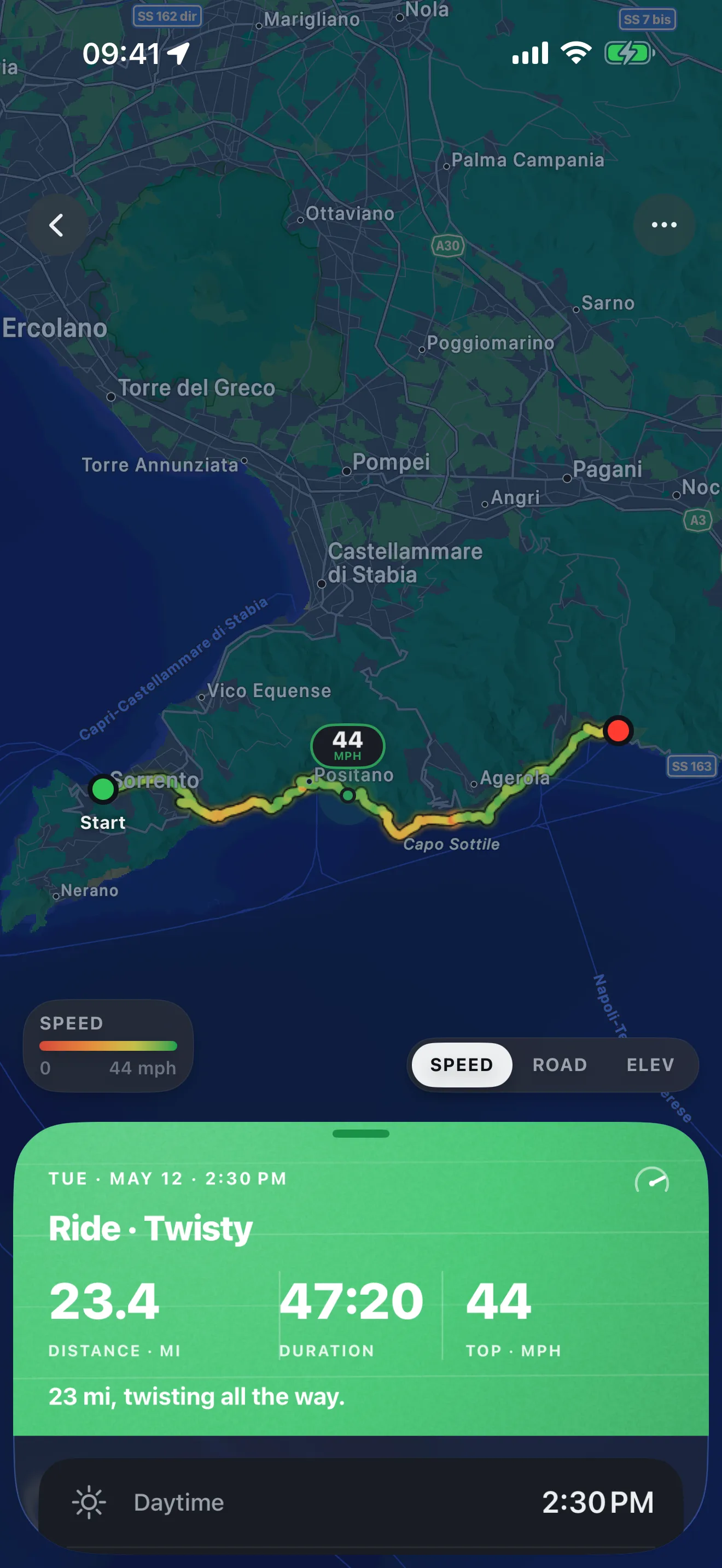
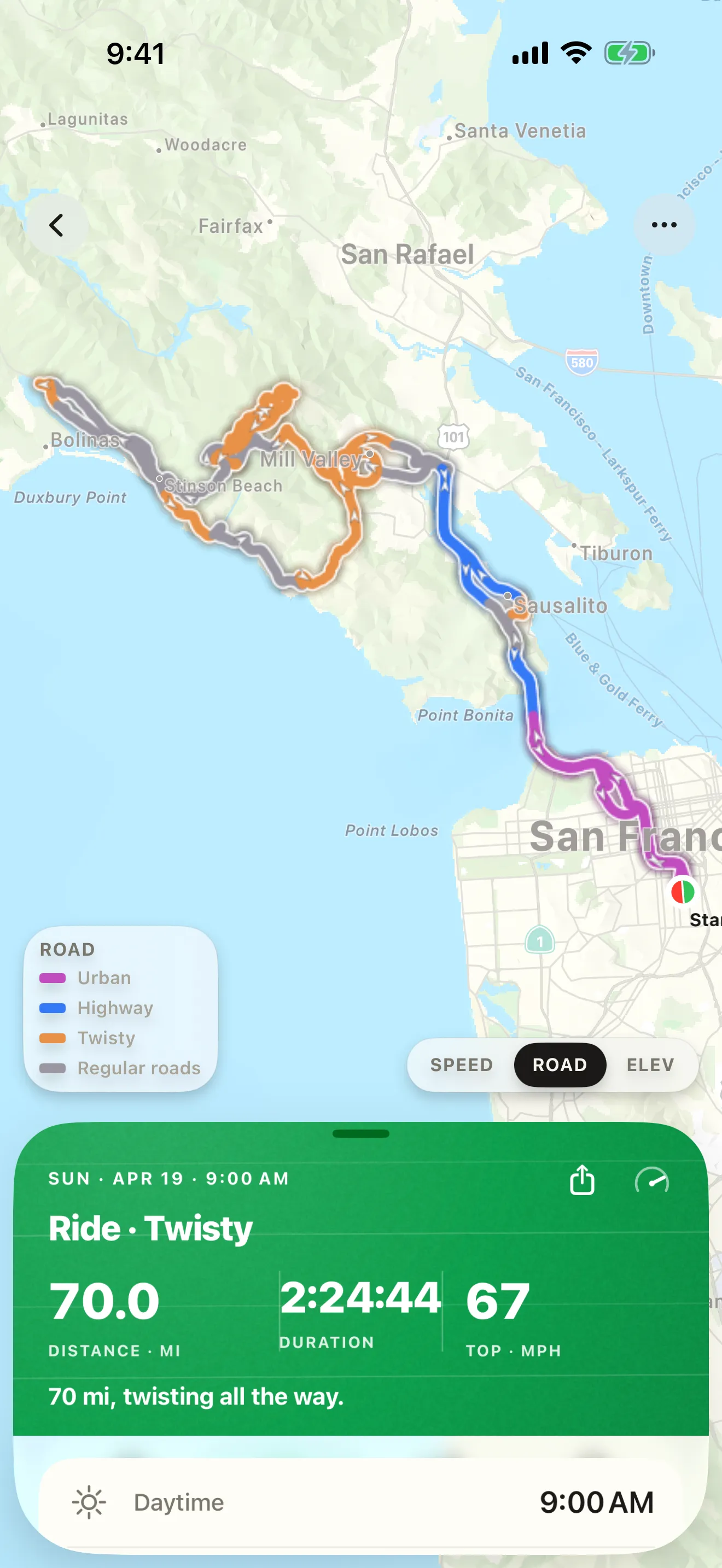
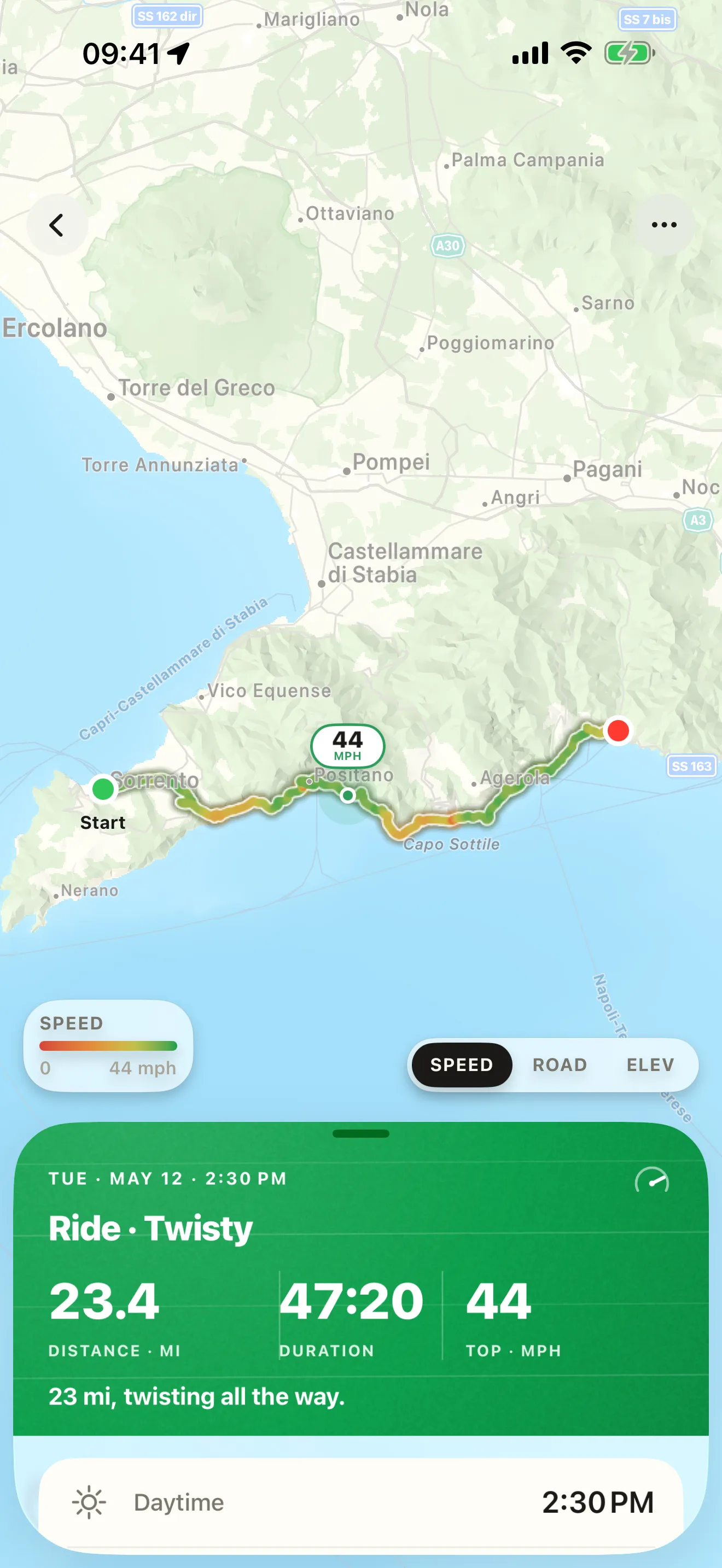
Open any ride and paint it by speed, by elevation, or by road type: urban in magenta, highway in blue, regular roads in grey, and twisty stretches in orange. A trip of several days shows each day in its own colour. And a ride you shared as a link picks up the new colours the next time you open Roveri.
- Twisty stretches in orange on the Road type layer
- Paint any ride by speed, elevation, or road type
- Each day of a journey in its own colour
- Shared ride links catch up with the new colours at the same address
EVERY RIDE, REMEMBERED
A year you can look back on.
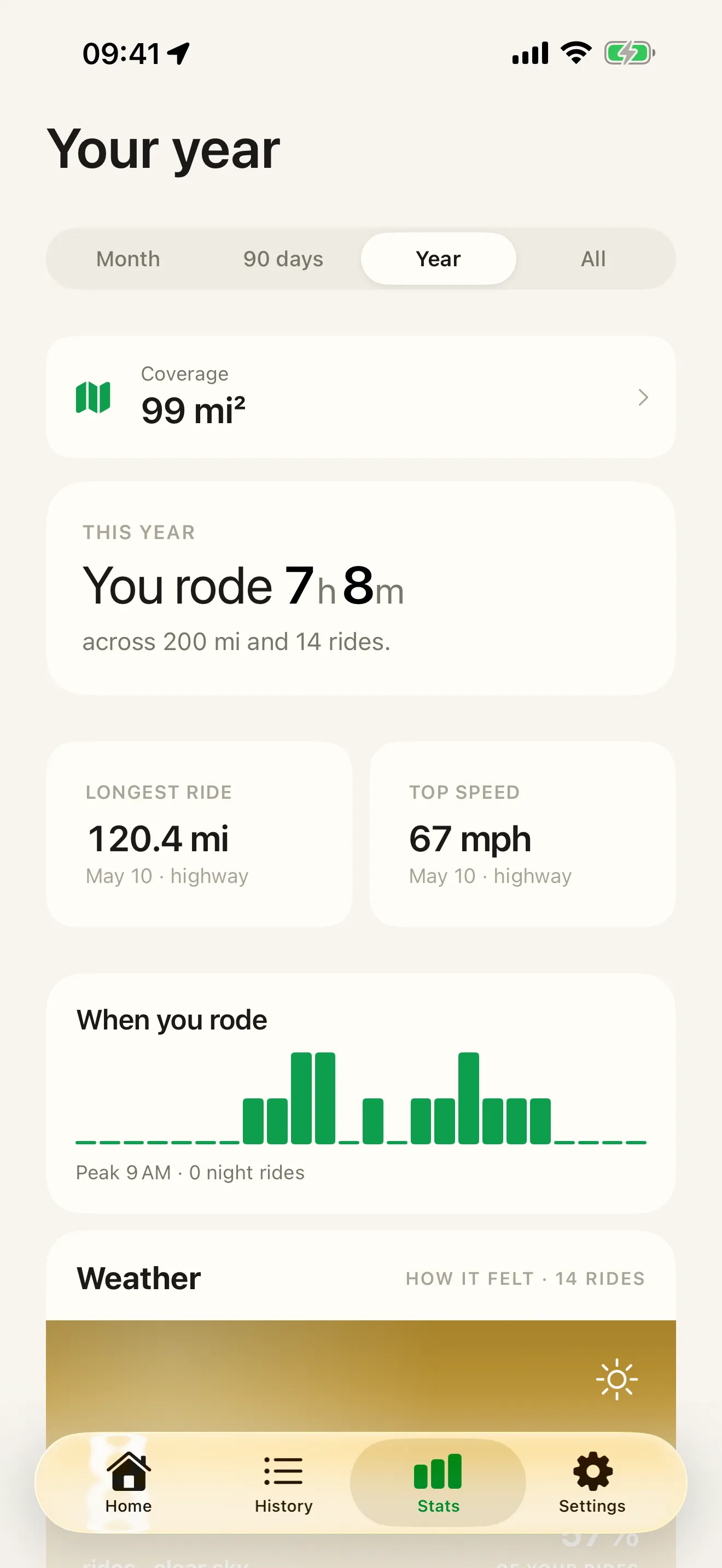
Every ride becomes an entry — and the entries become the shape of your year: the records, the roads, the weather you rode through. Filter, re-open, look back.
NEW · JOURNEYS
One trip. One journey.
A trip of several days is recorded as several rides. Make them one journey: one map with each day as its own line, every ride in order, shared as one link.
COMPARE
How Roveri compares
Roveri is a journal, not a navigator. Here's how it stacks up against the apps riders consider — point by point.
GUIDES
Straight answers for riders
The questions riders actually search — answered, with what Roveri does about them.